
AI land analysis
From a pin on the map to a full plot dossier, in minutes.
Land intelligence. Now.
Cadastre, municipal master plan (PDM), constraints and market for every plot, read from official sources and delivered in a report ready for a decision.
How it works
From request to answer on the same day, not in a week.
What changes when someone asks to look at a plot.
Today
The decision maker asks the land sourcer to look at a plot.
They open the municipal portal, the cadastre and the plan regulations one at a time, and gather the constraints.
The result goes to the architect to confirm. The answer waits for everyone's diary.
With TNow
A Google Maps link, the Google Earth KMZ or a pin on a phone.
Cadastre, plan, regulations, constraints, market and plan extracts, while the team does something else.
The land sourcer reviews the report and checks with the architect only what raises doubts. The answer goes out with the client's brand.
The value is in the speed of the answer: whoever asks gets the report on the same day, and the architect only steps in on the plots that pass the first filter.
Motometria estimates based on the current process of a retail consultancy in Portugal. They vary with the municipality and the depth of the analysis.
What TNow reads
Eight layers of information on every plot.
Everything that is searched today across different portals, in a single report.
Cadastre
Parcel, official area, tax article when it exists, and neighbours. A loose pin gets the outline of the parcel.
PDM
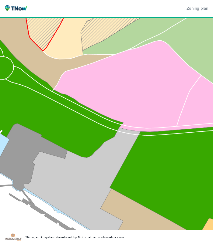
Land class and category, planning units and execution units, with the plan and the plot in red.
Regulations
Permitted uses, height, building ratio and suitability for retail, taken from the official text.
Constraints
Agricultural and ecological reserves (RAN, REN), power lines, roads, aviation easements, wildfire hazard and water domain.
Heritage and regeneration areas
Protection zones, listed buildings and urban regeneration areas.
Permits
Building permits and subdivisions on the plot or within 50 m, where the municipality publishes them.
Market
Residents within 1, 3, 5 and 10 km and the nearest store of each banner, by format.
Access
Motorway junctions, railway stations and planned roads.
In and out
In goes what the team already uses. Out comes something ready to use.
What only TNow does
Built for people who need to decide fast and without room for error.
It does not replace the architect or the land registry certificate. It does the searching so that they only step in where it is worth it.
Prospecting in reverse
Instead of analysing one plot at a time, it starts from the plan and returns the parcels that qualify. In Tomar it found 1,810 parcels of 3,000 m² or more on urban land, outside the agricultural and ecological reserves, in 7 minutes.
It reads the regulations
The 278 municipal plan regulations of mainland Portugal turned into rules per land category: which uses, what height, what building ratio.
It talks to the municipalities
It connects live to more than 20 municipal portals and, where the municipality does not publish its plans, draws the extract from the national register and says so.
Both of the country's cadastres
It joins the cadastre of the North with that of the Centre and South, and shows the neighbours of every parcel.
It does not stop
When a public service goes down, it uses its own copy of the cadastre and the report still comes out, with the date of the copy.
Comparison
Compared with what exists today.
The same plot, four ways to analyse it.
| Tool | All municipalities | Reads the regulations | Cadastre and neighbours | Ready report | Time per plot |
|---|---|---|---|---|---|
| Municipal portals | One at a time | No | Sometimes | No | 30 to 60 min of browsing |
| Property portals and market databases | Yes | No | No | Prices and listings | No planning analysis |
| Architecture and consultancy firms | Yes | Yes | Separate request | Yes | Hours to days |
| TNow | Yes, 278 | Yes, by AI | Yes | Yes, PT · EN · ES | 1 to 3 minutes |
Who it is for
For those who look for, value or answer questions about land.
From the consultancy that screens dozens of plots a week to the municipality that wants to answer an investor on the same day.
Retail and real estate consultancies
Dozens of plots screened every week, with the report in the client's brand.
Expanding retailers
Land, competition and residents around, in a single report.
Developers and funds
Screen opportunities before paying for studies and certificates.
Municipalities
Answer an investor on the same day and map the available urban land.
Brokerage and valuation
Know what a plot allows before putting a value on it.
Banking and insurance
Constraints and risks of a plot given as collateral.
Pricing
Monthly plans, no lock-in.
Provisional prices. Every plan includes the 278 municipalities, reports in PT, EN and ES, and updates.
- Up to 150 plots a month
- Prospecting by municipality
- Report in the client's brand
- Owner pipeline
- Up to 5 users
- Up to 500 plots a month
- Everything in Professional
- Unlimited users
- Dedicated follow-up
- Municipalities, banks and funds
- Volume and tailored integrations
- Dedicated installation
Provisional prices, VAT not included.
No plan? Order one-off.
To try it out or for a one-off request.
- Parcels that meet your requirements
- List and KMZ for Google Earth
Provisional prices, VAT not included. Online payment is being prepared: for now, orders are placed through the form and confirmed by email.
Book a demo
We show you TNow with your own plots.
Send us two or three plots you are looking at. In the demo you see the full report on each one, in 30 minutes.
Rather write directly?
[email protected]